I once worked with a man who lived in Lochore. He was a member of a brass band. He was in charge of making sure members of the band came to rehersals. Many a time I would overhear him shouting into his phone “Why can’t you cone to rehersal? If you don’t come tonight, I will make sure that you never play trumpet in Fife ever again!”
I’d recommend it for family’s or people who are starting out wild swimming as its a safe venue that is easy to access. Just watch out for brass bands. You don’t want to get on the wrong side of them or you will never swim in Fife again!
REVIEW
Ease of Access:
⭐⭐⭐⭐⭐
Rating: 5 out of 5.
Their is plenty of parking
Water quality:
⭐⭐⭐⭐⭐
Rating: 5 out of 5.
The water is checked and monitored.
Swim Quality:
⭐⭐⭐
Rating: 3 out of 5.
A good managed option if you don’t wan’t to swim in wilder location.
Other People:
⭐
Rating: 1 out of 5.
It can be very busy.
Would I go back:
It is good for beginners and it is a great starting point for people who want to move from the pool to outdoor swimming.
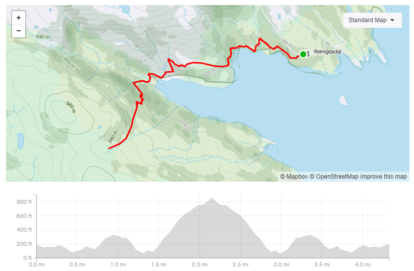
The postman’s path connects the small town of Tarbert with the even smaller town of Rhenigidale on the south-east edge of the Isle of Harris.
Until 1989, the only way for the outside world to reach Rhenigidale was by boat, or by this path. Goods and post were taken in and out via this route. WHich meant a very long walk for the postman. Thankfully Amazon did not exist back then or he’d never have been able to carry all the post over the hill.
The route can be done as a 13 mile circular path starting in Rhenigidale but I was a bit short for time so I did the spectacular first section as an out and back route.
There is parking in Rhengidale and the path is very obvious. Follow it until you reach the cairn.
I’m not the only person who has thought this. There has been rumours race organisers have tried to set up events here, but nothing has ever come to fruition. My guess is that the remote location, the lack of parking and lack of facilities makes it logistically difficult to bring in a large number of competitors to the area.
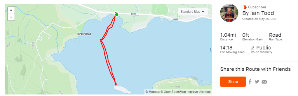
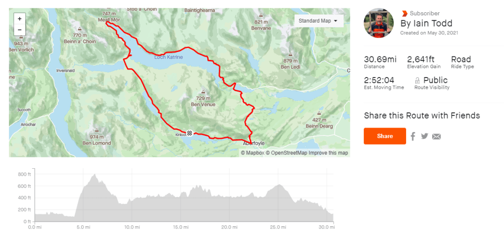
Instead of waiting for an official race I decided to do my own event. A friend of mine created the route. It starts with a 1500m swim in Loch Ard, then a 50Kish bike ride around Loch Katrine and then a 9km run to a viewpoint overlooking Loch Ard.
Swim – 1500m
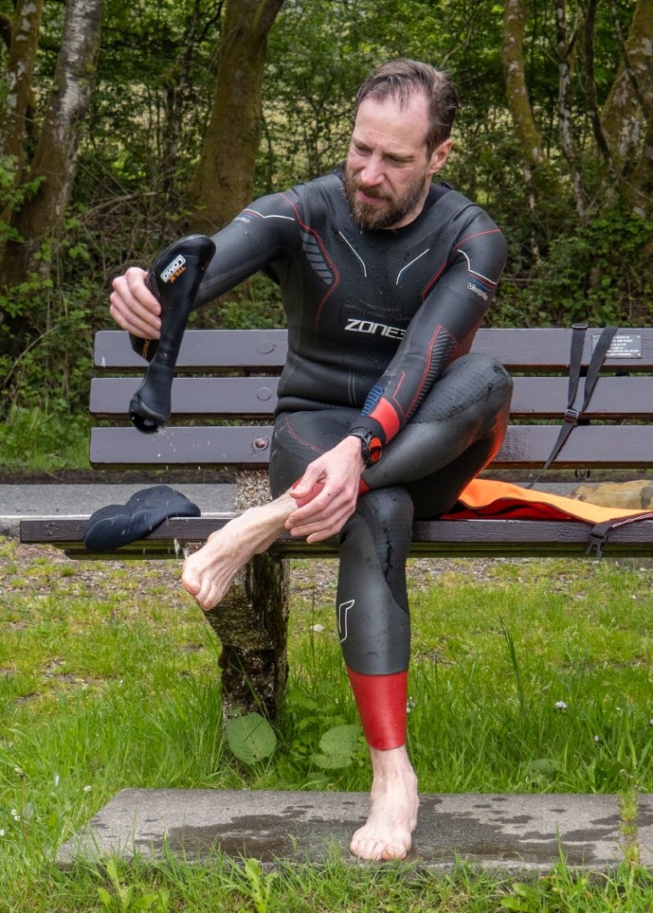
At 10AM on the 29th May 2001 Three triathletes entered the water to start the inaugural Loch Ard Triathlon. Only two of us would finish….
That sound quite ominous but it was because TwinBikeAndrew had to be back home by midday to have lunch and a walk with his baby daughter. He was only here to do the swim.
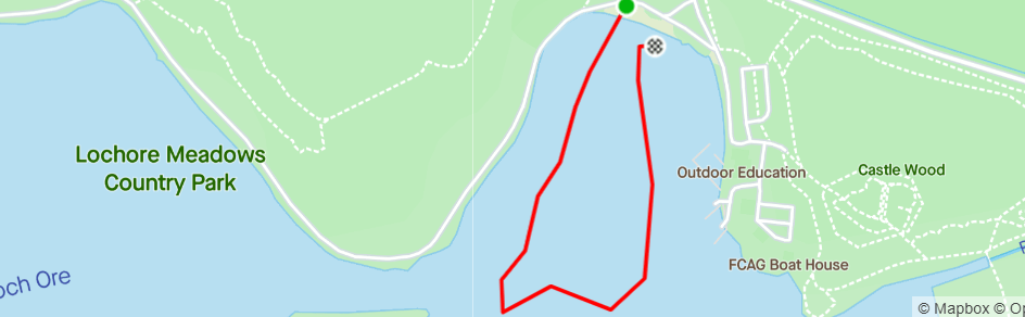
We decided to swim to an island. Stand on the island and then swim back. We thought this would be approximately 1500m. It was for two of us but TwinBikeAndrew took a scenic route – he did 2000m. He claims his googles were a bit foggy which prevented him from sighting properly. Its a massive island, how hard can it be to spot it?
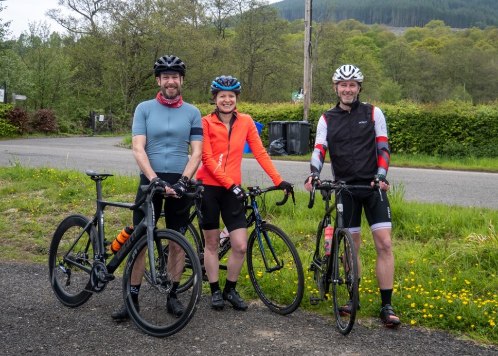
At 11am on the 29th May 2001 three triathletes got on their bikes and began the bike leg of the inaugural Loch Ard Triathlon.
At 1101am on the 29th May 2001 three triathletes got off their bikes and stopped the bike leg of the inaugural Loch Ard Triathlon. As one of them couldn’t get their Garmin watch to start recording. And, as everyone knows, if it is not on Strava then it didn’t happen. Therefore we had to wait whilst he fixed it so he could have it on Strava later.
The route was busier than usual. There was a lot of cars on what is normally a very quiet road. I think people were out enjoying the freedom of travel after travel restrictions had eased the week before this.
We choose to first head to the only major climb on the route – the Dukes Pass. My friend had a new bike. I joked he’d need to get a personal record for the climb otherwise the new bike would have to be sent back as faulty!
Thankfully he PR’d.
It was a nice morning for a ride. We took it easy and even stopped (unsuccesfully) at a cafe at the far end of Loch Katrine. We couldn’t buy anything as the cafe had a sign saying “cash only.” We had no cash. We weren’t the only ones. In the five minutes I stood near the café many folk wandered up to the front door, read the sign and then shouted back to friends or family “I haven’t any cash. Has anyone got cash?” Not many did.
At 1PM on the 29th May 2001 Three triathletes got off their bikes and began the run leg of the inaugural Loch Ard Triathlon. Only two finished….
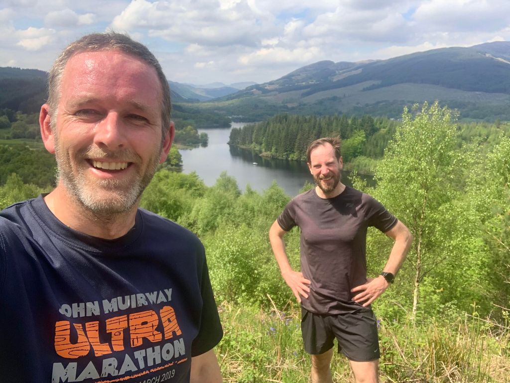
I think triathlon runs are commonly quite boring. They tend to be loops or out and back runs to nowhere in particular. For the run we decided to run to a viewpoint overlooking the Loch. I thought it would be about 10KM.
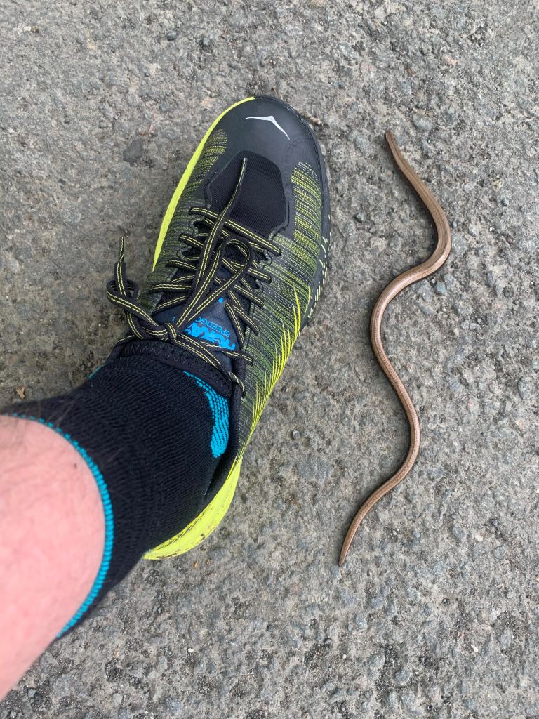
On the way out I spotted this guy.
I think it was a snake not a worm. I poked it with a stick. It slithered off in a very snake like way.
One of my friends stopped before the viewpoint as she didn’t fancy running up hills. Two of us carried onto the top
It was very warm!
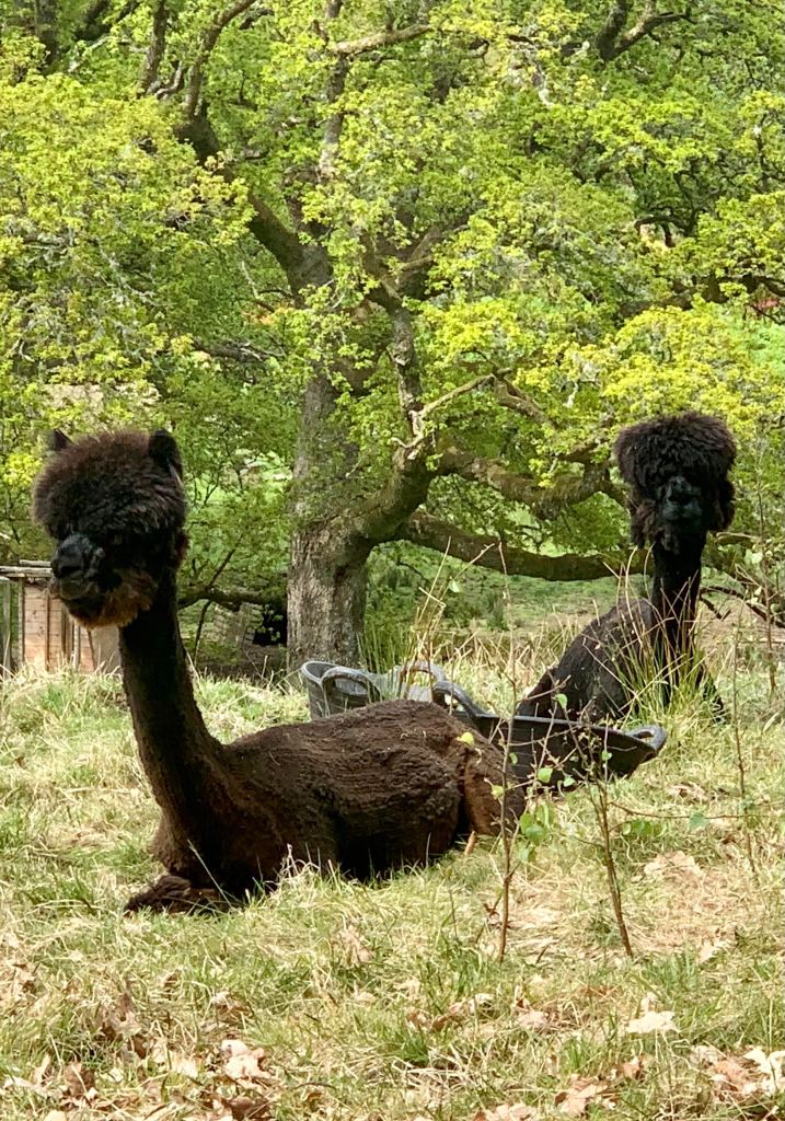
On the way back down to the start I spotted these weird creatures. It took a few looks before I realized they are naked Alpacas.
Which reminded me of the time I overheard two men looking at Alpacas.
Man 1 – Its a llama
Man 2 – Its an alpaca
Man 1 – NO. ITS A LLAMA
Man 2 – ITS A FUCKING ALPACA!
Man 1 – STICK YOUR APLACA UP YOUR ARSE!
I wish I cared about anything as much as those men cared about alpacas/llamas
When we got back to the the start we noticed it was only 8.9K. We run around in the car park until the distance said 9K. No-one likes finishing at .9 of a km.
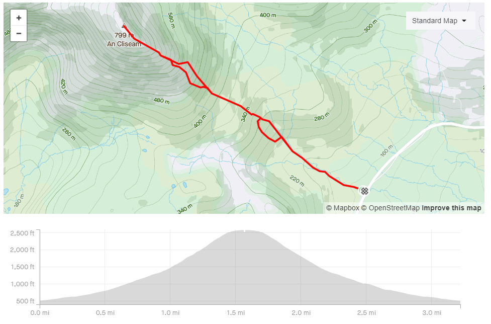
The Clisham is the highest point in the Western Isles On a good day it will reward summiteers with a great view across to mainland Scotland. On a bad day you will be rewarded with a very boggy, very steep climb and nothing to see from the top!
I’ve climbed it a few times and its fair to say I’ve had more bad days than good.
The forecast was good so I hoped this time I’d see something from the top. You can check out the video to see whether I did.
Film Friday is a weekly recommendation of one video to watch this weekend.
There are a lot of videos on YouTube about people’s running achievements. There are far less videos about people’s failures. This is one of the best – or one of the worst failures. It’s hard to pick the correct adjective when describing failure.
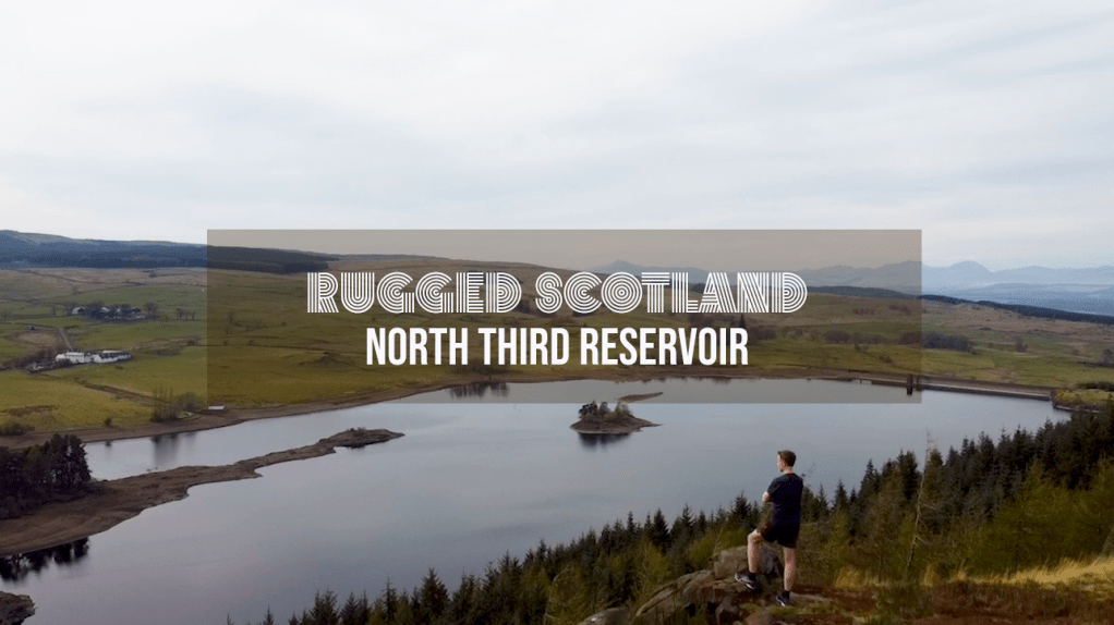
This visit was intended to be for a swim but there was one problem – lack of water in the reservoir. The water level was at least 8ft lower than my last visit which meant my usual swim loop was a (wet muddy) walk.
So instead I ran a loop around the reservoir. It was a nice 4 mile run that’s was easy to navigate. The path is well worn and easy to spot as its popular with dog walker and mountain bikers.
Check out the video below to see the great view from the top of the cliffs overlooking the reservoir.
John Muir was one of America’s most famous and influential ‘Outdoor Enthusiasts’ – although he described himself (in a ltter to a friend) as a “poetico-trampo-geologist-botanist and ornithologist-naturalist etc. etc.” Which must be annoying to write when he was filling in the job title section of application forms.
The John Muir Way is a 130 mile walking/biking route that stretches from his birthplace of Dunbar to where he left Scotland to head to America – Helensburgh. That is too far to run in one day but whilst looking at the route I noticed the section from Edinburgh to East Lothian is almost marathon distance if I went via as many beaches as possible.
I planned to start in in North Berwick and then get the train to Edinburgh but due to heavy traffic on the Edinburgh bypass it looked like I was going to miss the train. I drove to Longniddry instead and caught the train I should have got from North Berwick.
This complicated my run slightly as there is only one train an hour from North Berwick to Longniddry. I’d have to keep an eye on the time so that at the end of my run I didn’t miss a train and then have a long wait.
The first section of the route was from Waverly Station to Portobello beach.I used to live near the route so it was interesting to see places I used to visit – look there’s the Safeway I got my shopping in, look there’s that weird that always had scary people outside it, and look there’s that gym owned by a personal trainer to Hollywood celebrities’.
I was at the opening night of that Gym. I remember the personal trainer thanking everyone for coming. He asked his girlfriend to stand with him. He then he burst into tears as he blubbed about how much he loved her, how she had changed his life and how he’d do anything for her. She was really embarrassed at his speech and so was most of the audience. A couple of year later, I saw him on the front page of a tabloid paper. It turned out he wasn’t a nice man!
The first beach was Portobello beach or Puerto Bello Beach. Which I saw written in Graffiti on a wall next to the beach. I like the Spanish vibe of the name. It seems fitting when the weather is nice and the beach is full of happy people but maybe it is not so appropriate in the depths of winter.
The route from here to Gullane is very easy. Follow the John Muir way signs. I enjoyed this sections as I wasn’t very familiar with the towns of Musselburgh, Port Seaton and Cockenzie. They all had nice seas fronts to run along.
In Gullane I decided to ignore the John Muir Way. The official route goes south of the town but I wanted to go to the beach. It was definitely the correct decision. The coastal section here was my favorite part of the run. There was big sandy beaches and nice trail running.
Gullane was a good spot to pick up refreshments. I got chocolate and water from the local CO-OP.
I rejoined the John Muir Way as I left Gullane. I wanted to head to Yellowcraigs beach but I was conscious of time. The detour to the beach would mean I’d miss the next train from North Berwick to Longniddry and then I’d have a long wait.
I decided to head straight for the train. I’d see enough beaches for one day!
Check out the video below to see what the rote is like. I was running by myself so it’s mostly shots I could film quick and easily as I didn’t want to add too much time onto the run.
VIDEO
MAPS
Review
⭐⭐⭐⭐
Rating: 4 out of 5.
An interesting route but the road section might put people off doing it. If so you could start at the forest entrance instead
Parking
⭐⭐⭐
Rating: 3 out of 5.
North Berwick can be very busy so get there early to find a spot.
Facilities
⭐⭐⭐⭐
Rating: 4 out of 5.
Plenty of cafes and shops on the route.
Nearest cafe
⭐⭐⭐⭐
Rating: 4 out of 5.
Plenty of cafes and shops on the route.
Run Surface
20% road, 50% path. 30% off road.
Dog Friendly
Yes it is possible but I wouldn’t recommend the distance for a dog. I would only take my dogs on a shorter stretch of the route.
Sir James Matheson bought the Isle of Lewis for £190,000 in 1844. Yes – the whole island.
This was a lot of money back then. I wish I could say he earnt it legitimately but he earned his money through the sale of opium. He was a drug baron like Pablo Escobar but without all the murder and cocaine. Maybe not all drug barons are bad but I’ve seen a lot of Narco’s episodes on Netflix. It doesn’t paint drug barons in a good light.
Matheson did not immediately endear himself to locals. According to Stornoway Historical Society, the creation of the castle grounds involved the clearance of tenants and the re-routing of public roads. But over the next three decades, he spent a further £200,000 on island improvements such as roads, schools and harbours in an attempt to kickstart the island economy. So, maybe he wasn’t all bad.
The castle took six years to complete but the surrounding land took even longer. He imported trees to turn the area into extensive woodland. The area is now a great place for walking and running. The grounds are accessible to anyone courtesy of Lord Leverhulme. He bought the Isle of Lewis from Matheson. He had many ambitious plans, some of which were followed through, but most collapsed. He only owned the island for a few years before he gifted the Castle and grounds to the people of Stornoway.
The castle was closed for many years due to disrepair but in recent years it has been renovated and is now a popular hotel https://www.lews-castle.co.uk/