Rugged Run: Antonine Trail Race 10K (Iain)

This run follows the race route of the Antonine Trail 10K (https://antoninetrailrace.com/). The route passes by Antonine’s Wall. This was the furthest the Romans made it into Scotland. It is also referenced in the book World War Z which is about a zombie apocalypse. The wall was the last line of defence in Great Britain against zombies! I’ve done the route a few times and I’ve not seen any Romans or Zombies…yet.

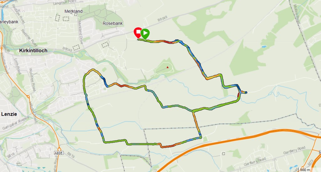
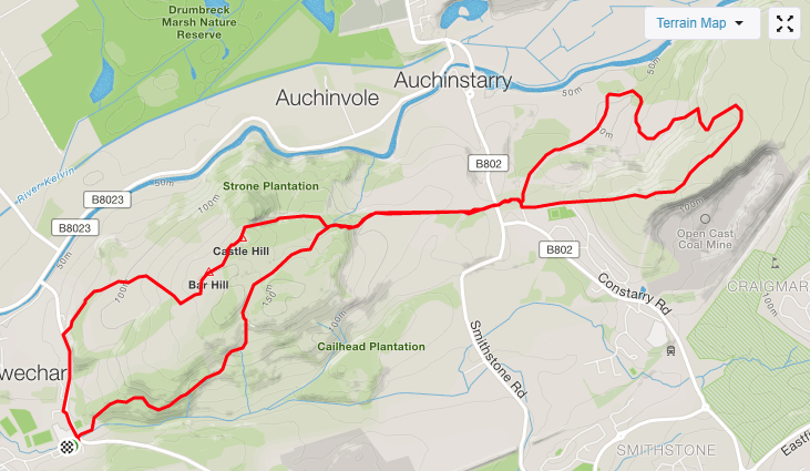
The route for the race starts in Croy but I live near Twechar so I normally do it from there instead. I will describe it as if its the race route.

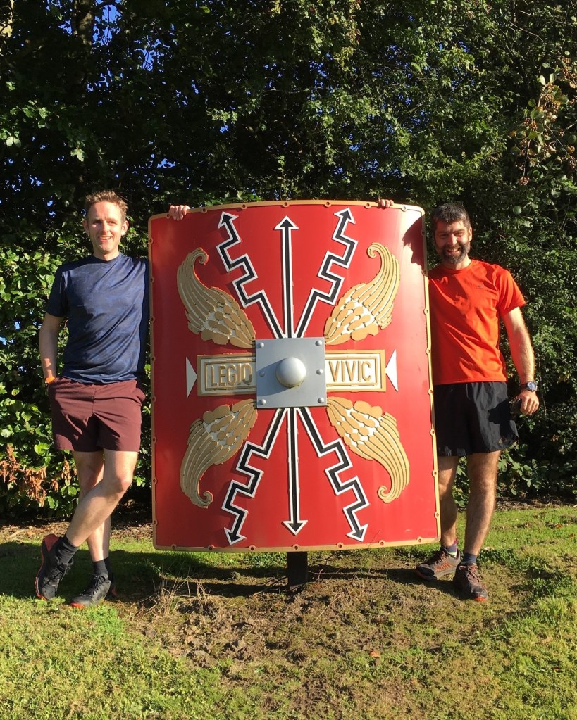
Start at the Roman Shield. It’s on the grass bank next to the car wash.

If that is the size of a Roman Shield then the soldier must have been huge!

Head down the hill towards the canal. Keep an eye out for a Shrine to the Virgin Mary. it was built around a natural spring in the mid 1970s by local residents.

Follow the path onto Croy Hill. I’ve heard other runners call it Mt Cookie but I’ve never found an explanation for why. Please get in touch if you know why.

There’s a few trees on top.

Head down off the hill and cross the road. Follow the path past the fields until you reach the forrest. Stay on the path. Don;t head right up onto Barr Hill. That is the way back.

Eventually you will head downhill through the Forrest.

Run Forrest Run

The run comes out in Twecher. A local told me “only Feckers come from Twecher.” I assume he had a bad expereience there! It seems allright to me.

Follow the road until you spot a turnoff to the right signposted Barrhill Fort.

The roman ruins at the top is what I call “a maybe place.” It is somewhere where all the signs says maybe as in “maybe this was where the soldiers slept” or “maybe this was one of several out buildings” I’d rather the historians just made stuff up as they obviously don’t know. Just write “maybe this was the en-suite bathroom” or “maybe this was the snooker room”

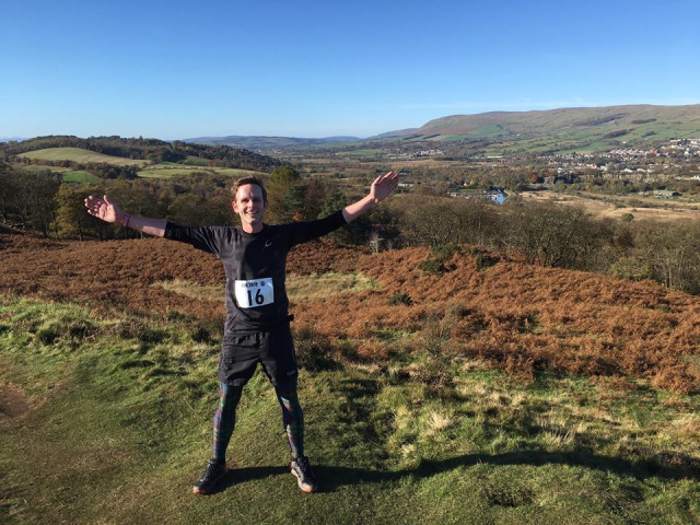
From the ruin keep left and head up to the trig point for a great view of the campsies. Head off the trig point down back to the sheep fields. Just before you get to the main road keep an eye out for a left turn. This will take you down to the marina. From here head back up to the top.

VIDEO

MAPS

https://www.strava.com/routes/2795962413585161278

Review

Rating: 5 out of 5.

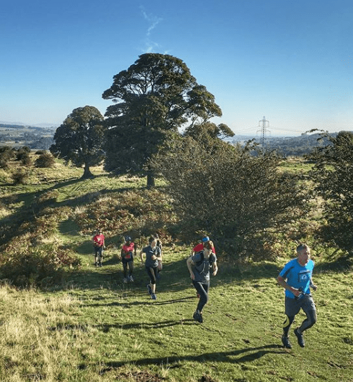
One of my favorite local routes due to the amazing views and the challenging course.

Parking

Rating: 5 out of 5.

There are plenty of places to park nearby.

Facilities

Rating: 3 out of 5.

None on the route but as it is a figure of eight I can get anything I need from my car when I pass by it.

Nearest cafe

Rating: 4 out of 5.

There is a cafe at the marina.

Run Surface

60% track, 40% off road

Dog Friendly

Yes but your dog will need to be on a lead at certain points due to the presence of sheep and cows.

Elevation

255M of elevation.

Rating: 10/10

An excellent route. Varied terrain, challenging hills and great views. What more could you ask for?

Film Friday – One Year Alone in a Forest (Iain)

Film Friday is a weekly (when I remember to do it) recommendation of one video to watch this weekend.

There is a famous tongue twister that goes “How much wood would a wood chuck chuck if a wood chuck could chuck wood?”

Try saying it again and again, faster and faster. It’s quite tricky.

I was reminded of it whilst watching this two hour study of one man, his big pike of wood and a lot of chopping. It is strangely calming to watch a man build a shed from scratch over two hours.

Give it a watch and see how long you can keep it on for.

Training For Celtman 2021 – February (Andrew)

Kirkintilloch Route: Blue areas show the hills

After last month’s brush with COVID, this month was just about getting back into a routine and getting close to the schedule I should have been following.

My original idea was to follow a Celtman training plan on TraingPeaks. For c£50 I bought a plan showing day by day the sessions I should be doing in order to give me the best chance to meet the cut off for running Ben Eighe. However, with the COVID lurgy I managed four days before I had to stop to become part of a global pandemic and then another three weeks where I had one week for it to pass, one week of a slight cough and then a third week of rest and only very light exercise before starting back again. this meant I’ve had three proper weeks of following the programme and so far I’ve done… not too bad. I’ve completed all sessions except for a couple of switches when I cycled instead of ran because the weather was too bad to go out and shortened a couple of the long cycles because I was doing them indoors and I don’t have the fitness yet to do more than two hours indoors. I work though on the principle that every minute indoors is worth two outdoors because you don’t pedal all the time outdoors and for every metre you climb when cycling from home then you also have a metre to descend….

To finish the month, we raced the Kirkintilloch 12.5k and managed to get the race bike out for its first outdoor ride this year. All in all, a good month considered. Now onto the crunch month: March and the impending announcement about whether Celtman will go ahead. Given Scotland is not due to start opening up un the end of April I’m giving it 50/50. It will be hard to have the race postponed again but given it’s due to take place less than two months after lockdown could end it’s a big step to get from opening up to hundreds of people in a remote part of the Highlands so shortly after that. We’ll find out next month though.

Rugged Run – Campsie Circular (Iain)

My ideal running route would start at my house and envolve a hill with a nice view that I can get to the top of before getting back in time for lunch.

Luckily, I live next to such a route but I’ve creatred the route so that it starts in Clachan of Campsie at the car park. If I marked the start as my house you would all be popping in to demand to use my loo or have a cup of coffee!

The route can be run in either direction but anti-clockwise is my preferred way as I can start with a nice flat run to warm up before tackling the hill. It’s then mostly downhill from the top with great views down the valley towards Strathblane.

I’ve run it in all weathers. I’ll admit this was one of the harder days. When I left the house the weather was sunny and the sky was blue but by the time I got to the top it was cold, snowy and I couldn’t see a thing.

Check out the video to see what I mean.

VIDEO

MAPS

Review

Rating: 5 out of 5.

My favorite local route as I can run it from my house and be back in time for lunch!

Parking

Rating: 3 out of 5.

There is car parking in Clachan of Campsie but it can get very busy on a nice day.

Facilities

Rating: 1 out of 5.

None on the route

Nearest cafe

Rating: 5 out of 5.

There is a cafe in Clachan of campsie

Run Surface

60% track, 40% off road

Dog Friendly

Yes but your dog will need to be on a lead when running near the farm before climbing up the hill towards cort ma law.

Elevation

519M of elevation.