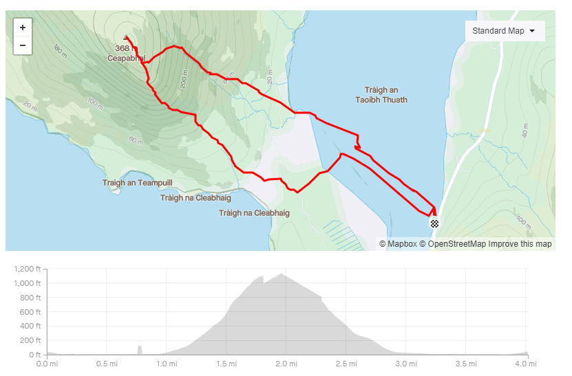
One of the joys of running the hills in harris is that I rarely, if ever, meet anyone else. Harris folk invented social distancing way before it was a covid thing.
I climbed this hill and didn’t see a soul until i was 20m from the summit. Two women appeared from a different direction and we all reached the summit at the same time!
They said that their should have been four of them but their husbands had given in because it was too steep.
It was a steep climb but I was lucky enough to do it on a beutiful day. the views from the top were amazing. Check out the video to see what I mean.
I wouldn;t recommend the route I took. I only realised when I got to the top that there was actually a path. Next time, I’ll use the path instead.
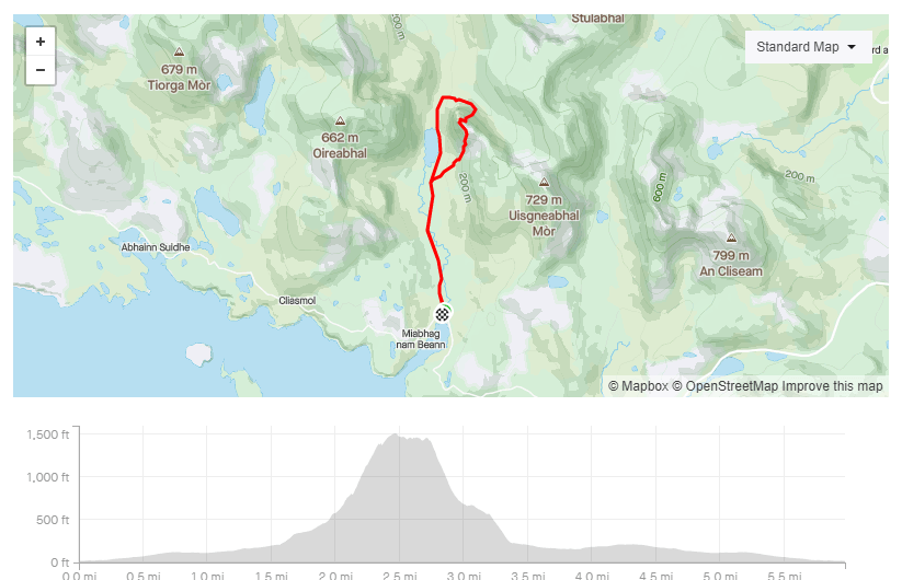
I’ve seen a golden eagle a few times whilst walking/running in Harris. They are very impressive sight. Ironically the only place I’ve not seen them is the Eagle Observatory!
I’m not alone in not spotting them. The observation book was full of comments saying “no eagles, just midges!”
It doesn’t matter if you don’t spot any. The walk is still worth doing to see the spectacular views.
I decided to climb up the hill next to the observatory. It was very steep and very treacherous on the way back down. I would recommend it if you are comfortable with steep off path climbs.
The callanish stones are a collection of standing stones on the west coast of the Isle Of Lewis.
There are a number of guesses as to there purpose
Some people believe it was men “converted into stone by an ancient enchanter”
Some people believe it was site to worship aliens.
And some people believe it was were Boris Jonson sacrificed his soul for eternal damnation or as its commonly known….leadership of the Tory party.
If you you are any of these people then I have some magic beans I’d like to sell you as you’ll obviously believe anything.
In truth, no-on really knows what the purpose of them is. All you need to know is that they look cool.
If you do visit then get there early. They are best enjoyed in solitude rather than with a crowd of folk taking selfies.
The Broch is an ancient type of croft house. Its very impressive but its currently being repaired. Its looks more like a building site than an ancient home. My dad claims there is a secret tunnel in it but I’ve never found it. He also claims small dwarfs switch on the street lights at night. I’d take anything he says with a pinch of salt.
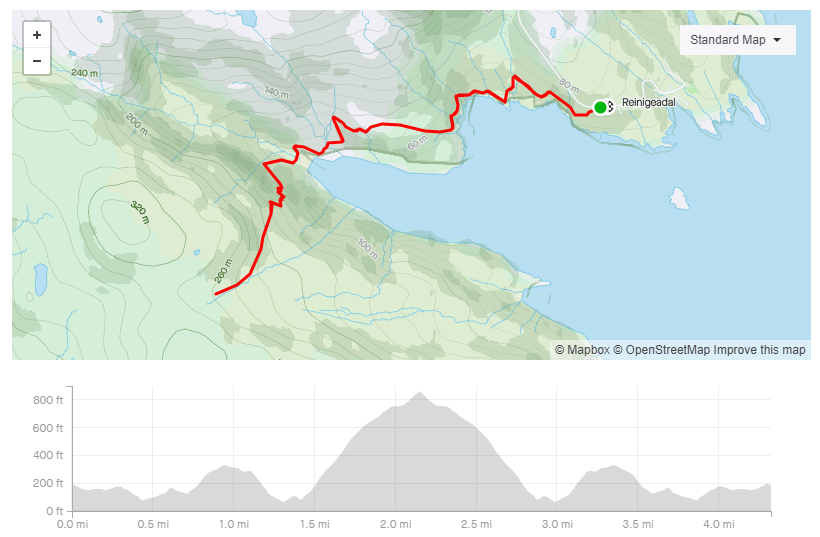
The postman’s path connects the small town of Tarbert with the even smaller town of Rhenigidale on the south-east edge of the Isle of Harris.
Until 1989, the only way for the outside world to reach Rhenigidale was by boat, or by this path. Goods and post were taken in and out via this route. WHich meant a very long walk for the postman. Thankfully Amazon did not exist back then or he’d never have been able to carry all the post over the hill.
The route can be done as a 13 mile circular path starting in Rhenigidale but I was a bit short for time so I did the spectacular first section as an out and back route.
There is parking in Rhengidale and the path is very obvious. Follow it until you reach the cairn.
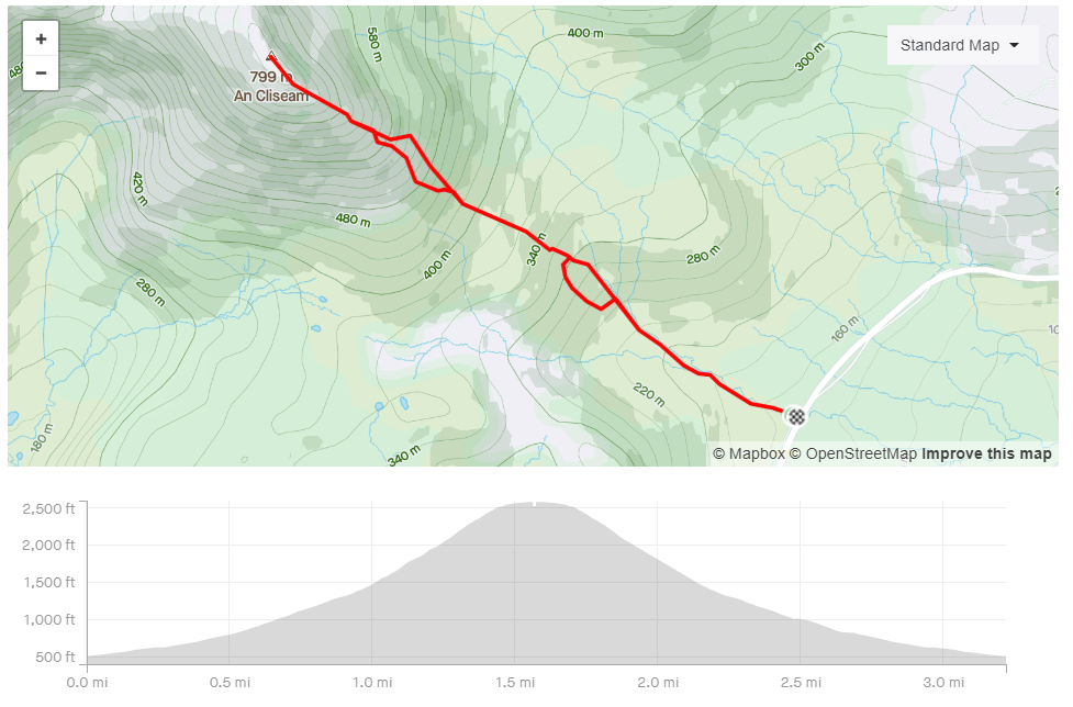
The Clisham is the highest point in the Western Isles On a good day it will reward summiteers with a great view across to mainland Scotland. On a bad day you will be rewarded with a very boggy, very steep climb and nothing to see from the top!
I’ve climbed it a few times and its fair to say I’ve had more bad days than good.
The forecast was good so I hoped this time I’d see something from the top. You can check out the video to see whether I did.
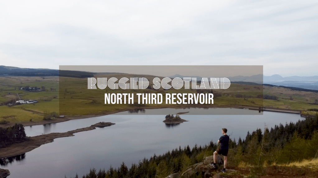
This visit was intended to be for a swim but there was one problem – lack of water in the reservoir. The water level was at least 8ft lower than my last visit which meant my usual swim loop was a (wet muddy) walk.
So instead I ran a loop around the reservoir. It was a nice 4 mile run that’s was easy to navigate. The path is well worn and easy to spot as its popular with dog walker and mountain bikers.
Check out the video below to see the great view from the top of the cliffs overlooking the reservoir.
John Muir was one of America’s most famous and influential ‘Outdoor Enthusiasts’ – although he described himself (in a ltter to a friend) as a “poetico-trampo-geologist-botanist and ornithologist-naturalist etc. etc.” Which must be annoying to write when he was filling in the job title section of application forms.
The John Muir Way is a 130 mile walking/biking route that stretches from his birthplace of Dunbar to where he left Scotland to head to America – Helensburgh. That is too far to run in one day but whilst looking at the route I noticed the section from Edinburgh to East Lothian is almost marathon distance if I went via as many beaches as possible.
I planned to start in in North Berwick and then get the train to Edinburgh but due to heavy traffic on the Edinburgh bypass it looked like I was going to miss the train. I drove to Longniddry instead and caught the train I should have got from North Berwick.
This complicated my run slightly as there is only one train an hour from North Berwick to Longniddry. I’d have to keep an eye on the time so that at the end of my run I didn’t miss a train and then have a long wait.
The first section of the route was from Waverly Station to Portobello beach.I used to live near the route so it was interesting to see places I used to visit – look there’s the Safeway I got my shopping in, look there’s that weird that always had scary people outside it, and look there’s that gym owned by a personal trainer to Hollywood celebrities’.
I was at the opening night of that Gym. I remember the personal trainer thanking everyone for coming. He asked his girlfriend to stand with him. He then he burst into tears as he blubbed about how much he loved her, how she had changed his life and how he’d do anything for her. She was really embarrassed at his speech and so was most of the audience. A couple of year later, I saw him on the front page of a tabloid paper. It turned out he wasn’t a nice man!
The first beach was Portobello beach or Puerto Bello Beach. Which I saw written in Graffiti on a wall next to the beach. I like the Spanish vibe of the name. It seems fitting when the weather is nice and the beach is full of happy people but maybe it is not so appropriate in the depths of winter.
The route from here to Gullane is very easy. Follow the John Muir way signs. I enjoyed this sections as I wasn’t very familiar with the towns of Musselburgh, Port Seaton and Cockenzie. They all had nice seas fronts to run along.
In Gullane I decided to ignore the John Muir Way. The official route goes south of the town but I wanted to go to the beach. It was definitely the correct decision. The coastal section here was my favorite part of the run. There was big sandy beaches and nice trail running.
Gullane was a good spot to pick up refreshments. I got chocolate and water from the local CO-OP.
I rejoined the John Muir Way as I left Gullane. I wanted to head to Yellowcraigs beach but I was conscious of time. The detour to the beach would mean I’d miss the next train from North Berwick to Longniddry and then I’d have a long wait.
I decided to head straight for the train. I’d see enough beaches for one day!
Check out the video below to see what the rote is like. I was running by myself so it’s mostly shots I could film quick and easily as I didn’t want to add too much time onto the run.
VIDEO
MAPS
Review
⭐⭐⭐⭐
Rating: 4 out of 5.
An interesting route but the road section might put people off doing it. If so you could start at the forest entrance instead
Parking
⭐⭐⭐
Rating: 3 out of 5.
North Berwick can be very busy so get there early to find a spot.
Facilities
⭐⭐⭐⭐
Rating: 4 out of 5.
Plenty of cafes and shops on the route.
Nearest cafe
⭐⭐⭐⭐
Rating: 4 out of 5.
Plenty of cafes and shops on the route.
Run Surface
20% road, 50% path. 30% off road.
Dog Friendly
Yes it is possible but I wouldn’t recommend the distance for a dog. I would only take my dogs on a shorter stretch of the route.
Sir James Matheson bought the Isle of Lewis for £190,000 in 1844. Yes – the whole island.
This was a lot of money back then. I wish I could say he earnt it legitimately but he earned his money through the sale of opium. He was a drug baron like Pablo Escobar but without all the murder and cocaine. Maybe not all drug barons are bad but I’ve seen a lot of Narco’s episodes on Netflix. It doesn’t paint drug barons in a good light.
Matheson did not immediately endear himself to locals. According to Stornoway Historical Society, the creation of the castle grounds involved the clearance of tenants and the re-routing of public roads. But over the next three decades, he spent a further £200,000 on island improvements such as roads, schools and harbours in an attempt to kickstart the island economy. So, maybe he wasn’t all bad.
The castle took six years to complete but the surrounding land took even longer. He imported trees to turn the area into extensive woodland. The area is now a great place for walking and running. The grounds are accessible to anyone courtesy of Lord Leverhulme. He bought the Isle of Lewis from Matheson. He had many ambitious plans, some of which were followed through, but most collapsed. He only owned the island for a few years before he gifted the Castle and grounds to the people of Stornoway.
The castle was closed for many years due to disrepair but in recent years it has been renovated and is now a popular hotel https://www.lews-castle.co.uk/
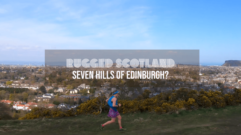
I’ve previously written about the annual Seven Hills Race in Edinburgh. Find out more here. It is a great race and I recommend it…as long as you like hills.
I decided to run the route to celebrate the first day of the end of a travel ban in Scotland. Coronovirus restrictions (in the previous six months) meant I hadn’t been able to travel further than my own county.
I decided to avoid the countryside hills where I thought everyone else would go. Instead, I treated myself to a trip to Edinburgh. My friend Fiona Outdoors (https://www.fionaoutdoors.co.uk/) had never done the route. She decided to join me. She was relying on me for directions.
I thought the route was 14 miles and seven hills. We ended up doing 18 miles and 8 hills! Next time she won’t rely on me for directions.
You might ask, how is it possible to run eight hills in a seven hill race? Well, it was because one of the hills is actually two summits. The race only goes over one summit. We went over both. I’d argue that it is quite clearly two hills not one but I’m not a geologist. I presume there is a proper explanation for why it’s not two hills so I googled it and got:
“The two summits of Craiglockhart Hill form a prominent landmark which has resulted from the fact that the igneous rock is more resistant to erosion than the surrounding sedimentary rock. The recent ice sheet in particular has helped to mould the present landscape. The igneous rock consists of lava flows and ash layers giving the appearance of bedding which dips towards the west. A short walk to the summit rewards you with breathtaking views of Edinburgh while the southern slopes offer recreation in the form of golf. The local nature reserve is frequently used by the community and has also achieved status as a Biological Site of Special Scientific Interest. The valley between East and West Craiglockhart is probably a glacial meltwater channel.”